QGIS Desktop Basics (Introduction to QGIS)
QGIS Desktop Basics (Daniel Ursprung):
Fridays, October 15th, 22nd and 29th, 2021, 10:00 - 16:00 h
Target audience: students as well as teaching, research and administrative staff at UZH (free of charge), no prior knowledge or experience with QGIS required
Course content: see below
Course description
Learning objectives
- Participants know the key concepts of GIS as well as the basic operations to visualize, edit and process spatial data (vector and raster).
- Participants know where they can find spatial data for their needs (file-based and WebServices).
- Participants are able to produce different visualizations of their data.
- Participant can draw their own maps and save them as static image file or publish them as dynamic WebMap.
- Introduction to the open source GIS software QGIS, overview and possible applications.
- Introduction to QGIS graphical user interface, key concepts (project settings, data management, coordinate reference systems, layers).
- Geodata: Data formats, reference sources; creating and importing own data, linking table data as spatial attributes
- Analyzing and editing vector data: working with attributes, processing tools, digitizing, topological editing
- Display options, labeling, diagrams
- Basics of working with raster data (georeferencing, working with digital elevation models, raster calculators, etc.)
- Working with selected QGIS plugins
- Creating and output of thematic and topographic maps with the layout manager, atlas function, export of interactive WebMaps
- Self service resources: Tutorials, help, documentation
Requirements/prior experience
None. Standard skills working with a desktop computer.
Participants
Stundent, teaching, research and administrative staff (UZH)
Literature: software guides
- Anita Graser, Andrew Cutts: Learn QGIS. Your step-by-step guide to the fundamental of QGIS 3.4. Birmingham: Fourth Edition 2018.
- Kurt Menke: Discover QGIS 3.X. A workbook for the classroom or independent study. Chugiak 2019.
- Anita Graser, Gretchen N. Peterson: QGIS map design. Chugiak 2016.
- Die QGIS Dokumentation bietet auf ihrer Webseite auch einen QGIS Training Guide an: https://www.qgis.org/en/docs/index.html
How to find our course room: Windows Training classroom RAI-E-131: address: Rämistrasse 74, (tram 5 or 9 to station Kantonsschule or tram 5 or 9 to station Platte. See map below (or in Full-Screen in new window).
For navigation devices: 47.3735 N 8.551 E - download gpx-file (GPX, 492 bytes)
See location on your prefered map portal
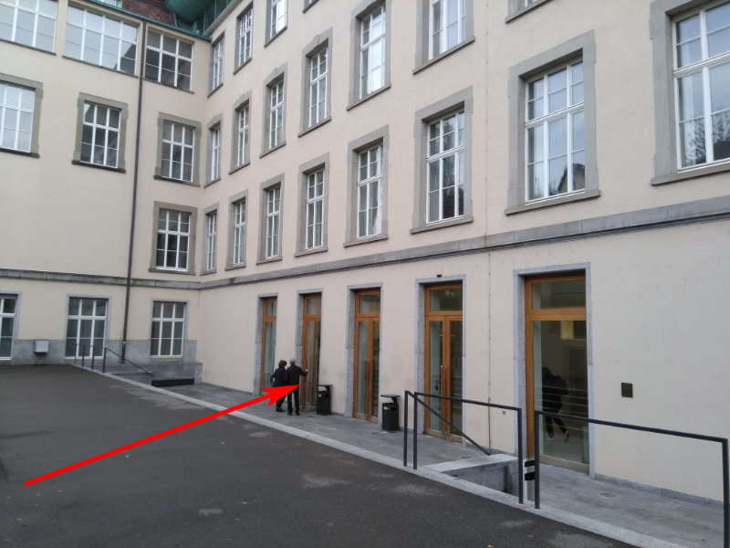
Building entrance: easiest to use is the backdoor entrance, entering from Schönleinstrasse (image 1), leading to UZH's Law library entrance hall.
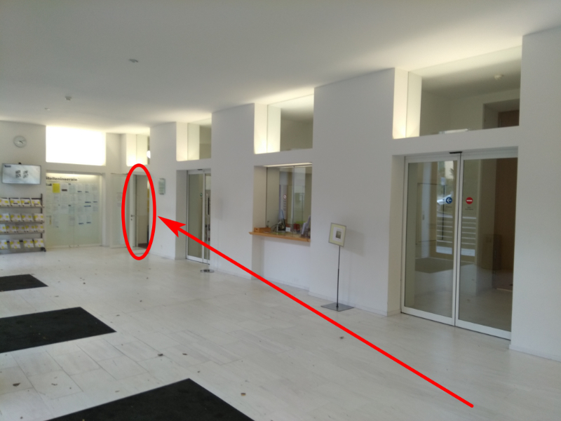
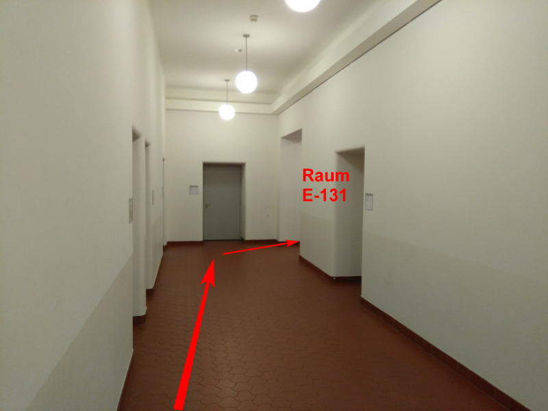
Inside the building: once inside the building, in the library's entrance hall turn left (image 2), go through the corridor with the lockers (image 3) and, reaching the next corridor, once again turn left. At the end of this second corridor, you'll see our course room on the right hand side (image 4).
|
|
|
|

